Strategic Location
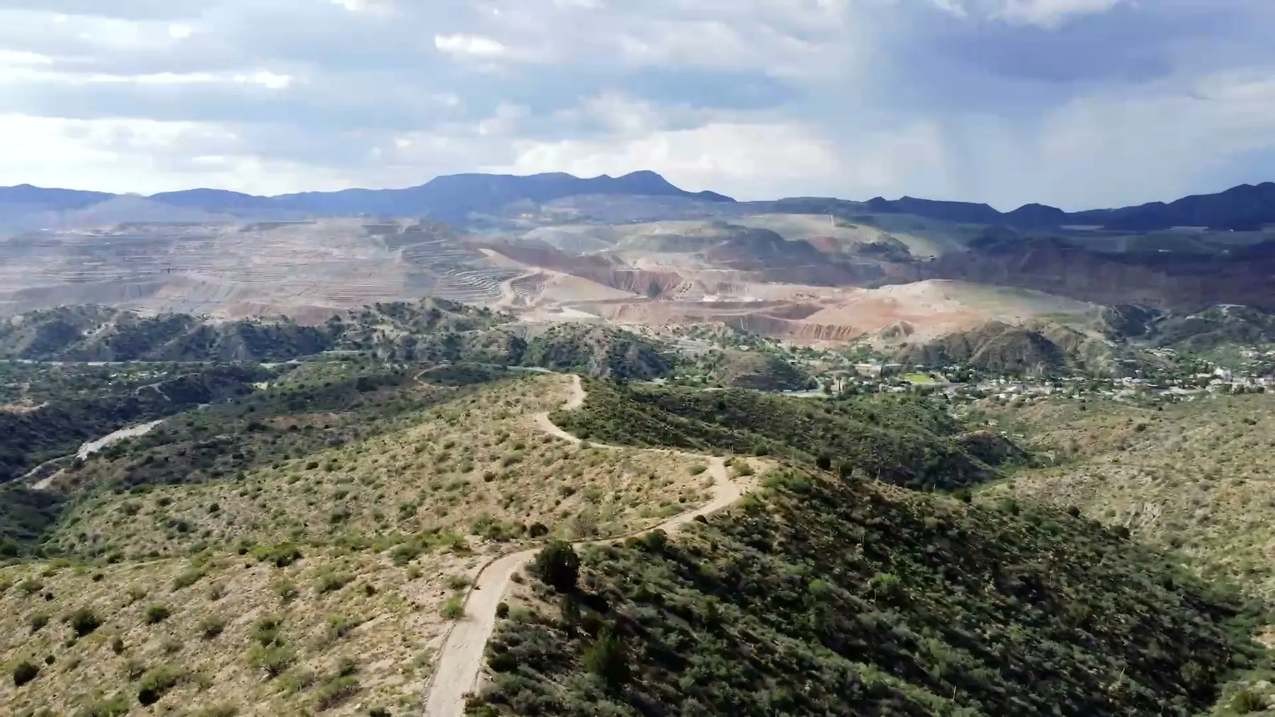
Only 60 miles from Phoenix Airport, providing excellent accessibility and logistics.
Our Projects
A world-class copper district with exceptional infrastructure and proven mining potential.
Arizona Copper Triangle
Only 60 miles from Phoenix Airport, providing excellent accessibility and logistics.
The region has produced 37 billion lbs of copper to date and holds 95 billion lbs of known copper reserves and resources.
Direct neighbor of some of the world's largest copper producers including Asarco/Grupo Mexico, BHP, Capstone, Freeport McMoRan, KGHM, Rio Tinto, and South32.
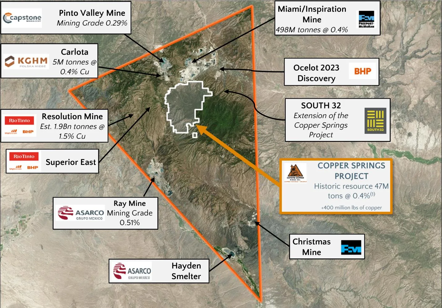
22,086 acres across 1,100 claims at the centre of the Globe-Miami district, permitted for Phase 1 drilling at 37 locations.
22,086 acres
1,100 BLM mining claims (89.4 km²), plus 223.85 acres of patented land at the Gibson Mine
47M tons @ 0.4% Cu
(1) Non-43-101 compliant historical resource
All infrastructure available with multiple nearby mines in operation. Direct access on Forest Land Road from Highway 60.
Natural occurring springs exist on the property. Water permits will need to be obtained for usage with no competing uses in the area.
(1) The 47M tons @ 0.4% Cu estimate (NI 43-101 Technical Report, Feinstein, 2022) is historical in nature and does not conform to current NI 43-101 standards. It is considered relevant and reliable for reference purposes but should not be treated as a current mineral resource.
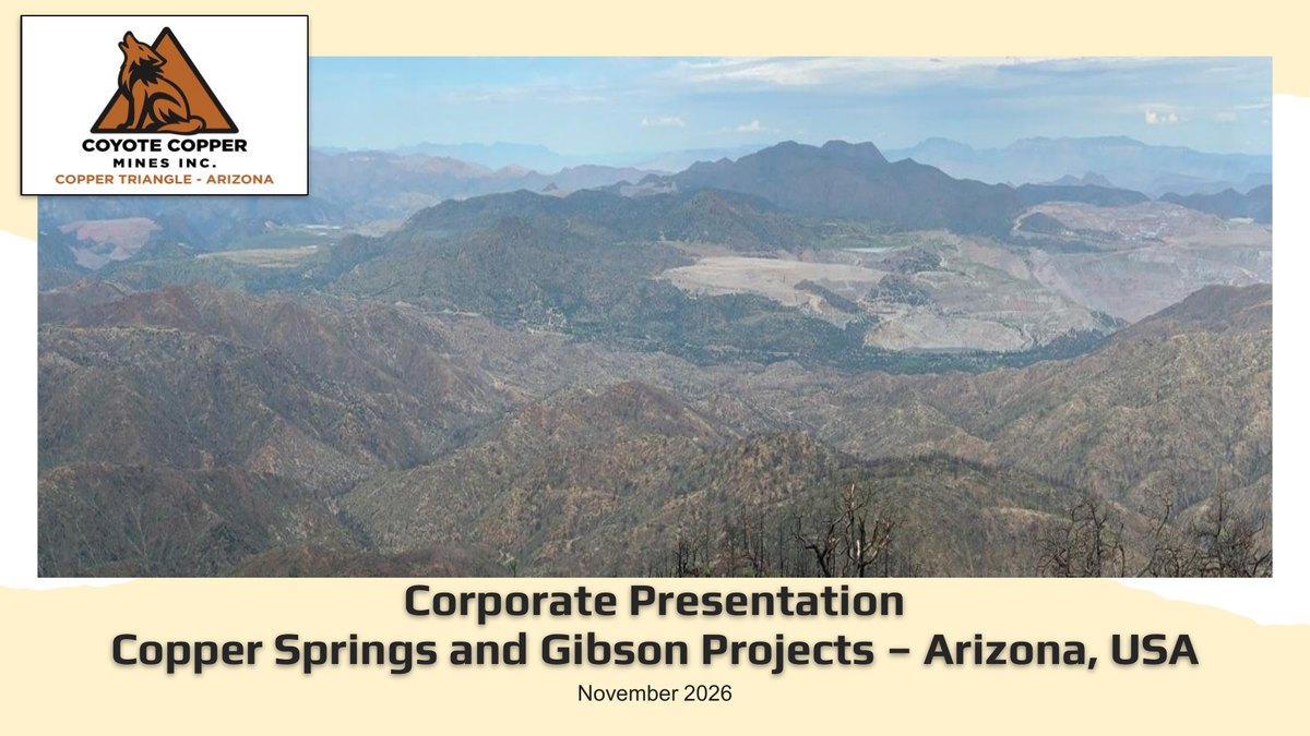
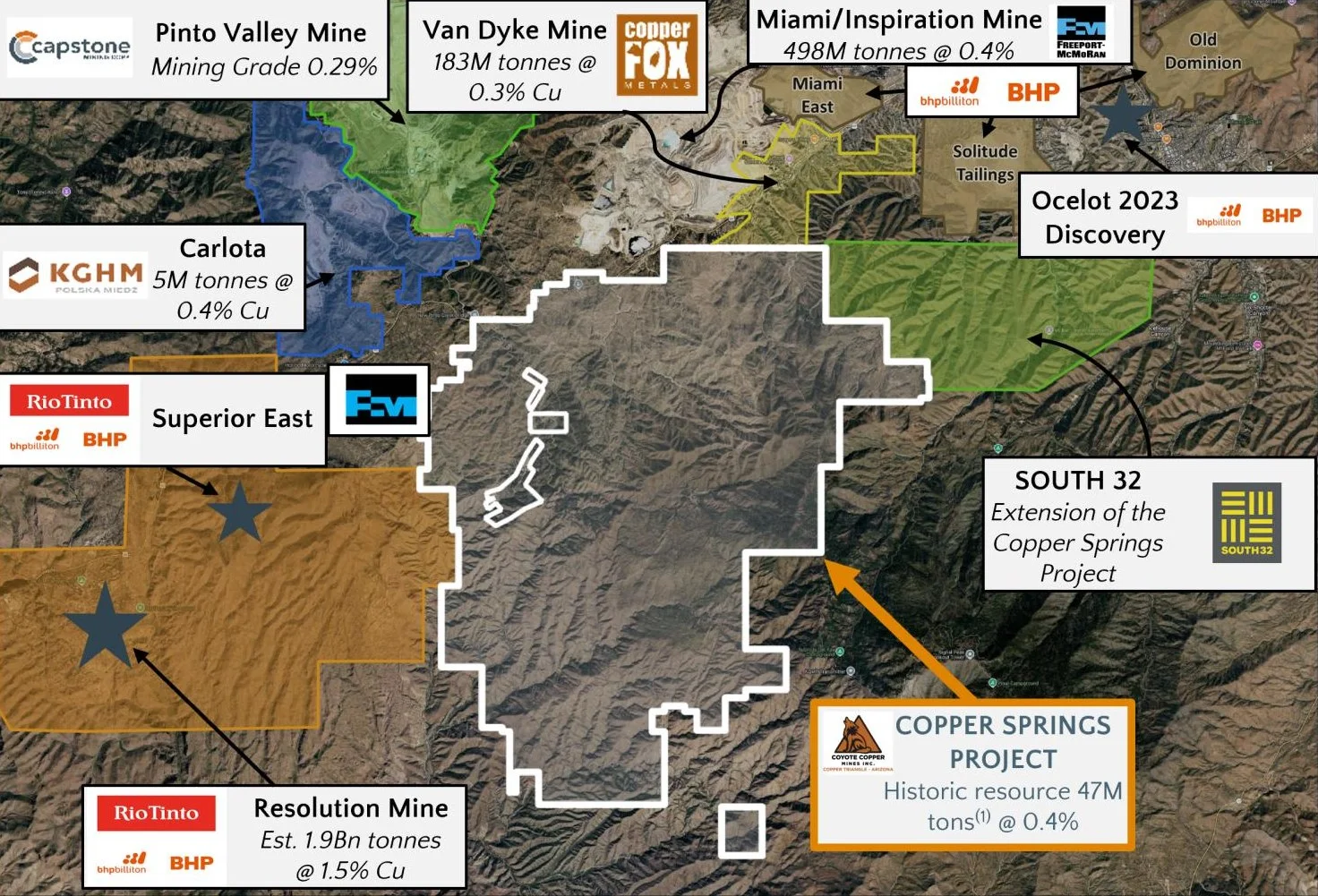
Copper Springs is surrounded by Capstone’s Pinto Valley, Freeport-McMoRan’s Miami-Inspiration, KGHM’s Carlota, Rio Tinto and BHP’s Resolution and the South32 extension of the Copper Springs Project.
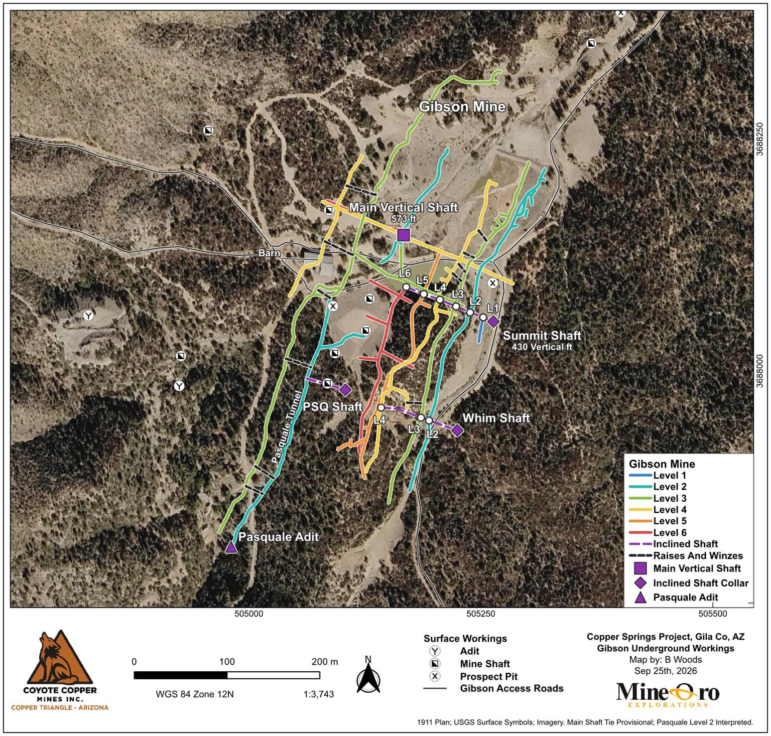
Gibson Mine
Coyote Copper purchased the historic Gibson Mine on November 3, 2026. The mine sits on 223.85 acres of patented land made up of three patented mining claims.
*An in-situ estimate in the USGS MRDS record (#10104088), taken from the K.R. Long 1995 compilation of porphyry copper deposits. These estimates are historical in nature, not compliant with NI 43-101, and should not be treated as current mineral resources.
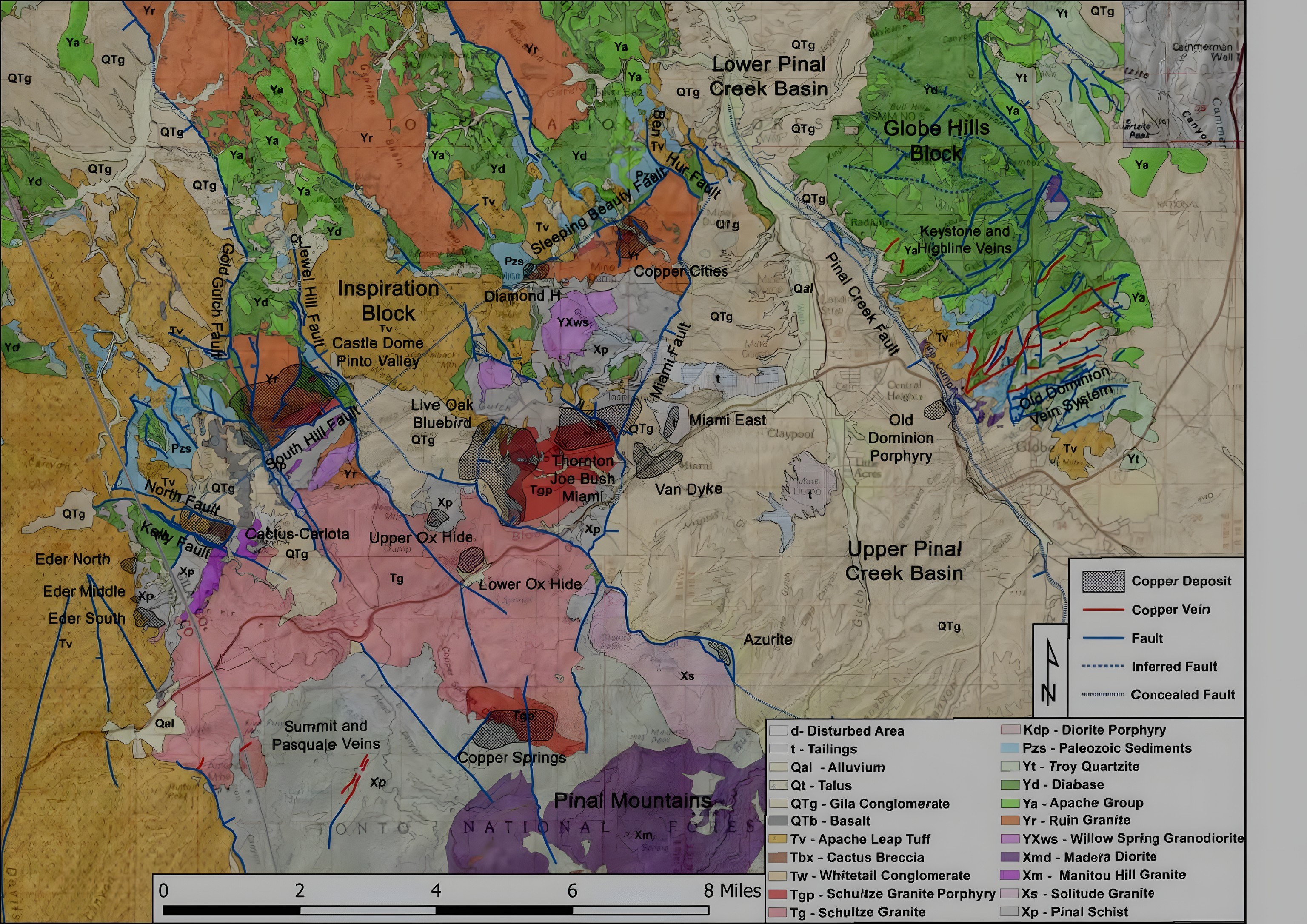
The Globe-Miami district
Copper Springs sits in the centre of the Superior-Globe-Miami district, covering several kilometres of the margin of the Schultz Granite, the same setting as the deposits around it.
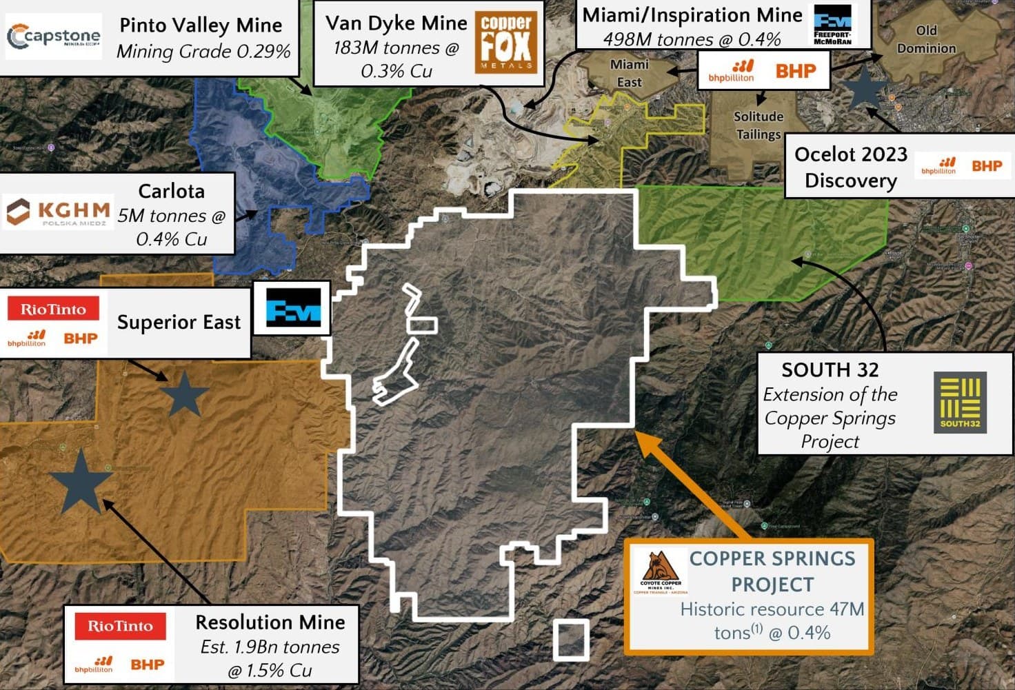
Neighbouring resource figures are 2022 totals reported by their operators, as summarized in the Company’s May 2026 presentation. Coyote Copper has not verified them and they are not necessarily indicative of mineralization at Copper Springs.
Geology
The Globe-Miami district comprises three rotated and dismembered porphyry centres. Two of them host operating mines at Pinto Valley and Miami-Inspiration. The third, the Copper Springs System, runs right through the Copper Springs property.
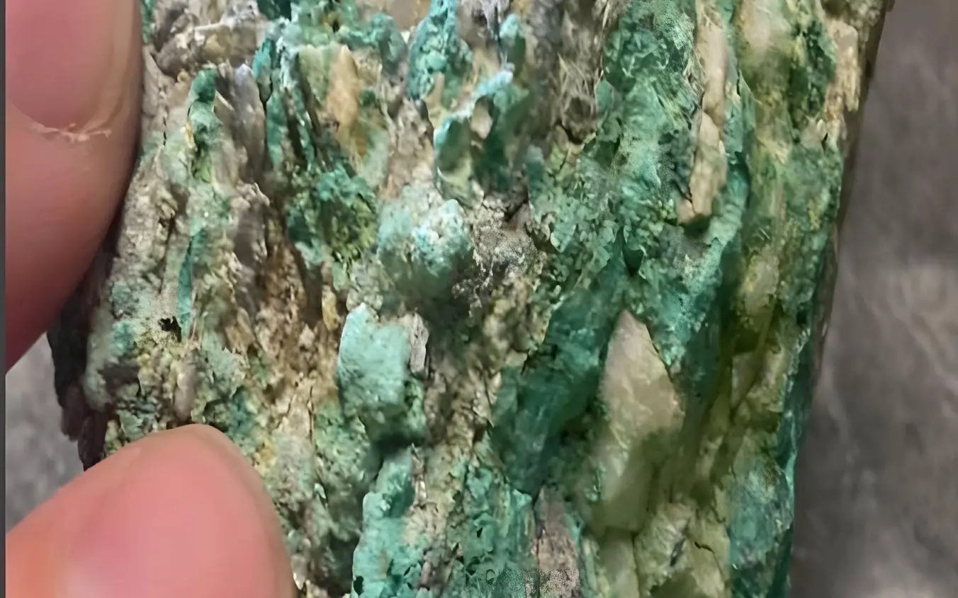
Current geophysical and geochemical data outline a 3 km by 3 km by 1.4 km subsurface anomaly, interpreted as a large intrusive-hydrothermal centre consistent with a porphyry copper system. Surface and near-surface sampling has returned copper values up to 1,000 ppm.
Copper Springs Project
The Globe-Miami district is made up of three rotated and dismembered porphyry centres. Two of them host operating mines at Pinto Valley and Miami-Inspiration. The third, the Copper Springs System, crosses the heart of the Copper Springs claims.
See the exploration program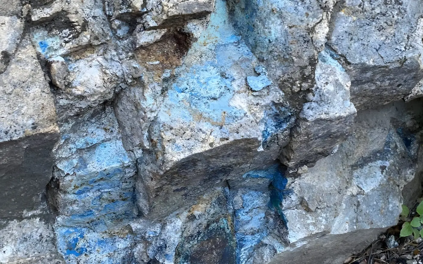
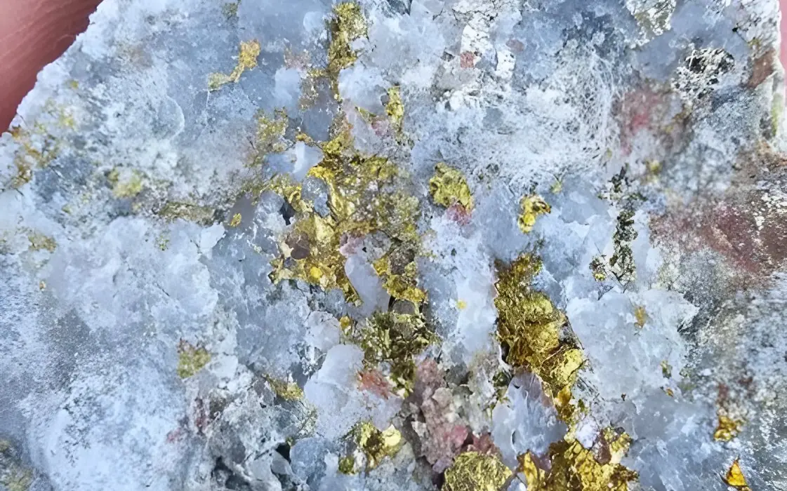
Exploration
Coyote Copper Mines has received its Phase 1 drill permits for 37 drill locations and signed a drilling contract. Drilling is scheduled to start on November 16, 2026.
Drill roads and pads are being built and all necessary permits are in hand. Each approved location can host multiple drill holes, and the campaign will test both shallow oxide and deeper sulphide copper targets.
Read the October 16 release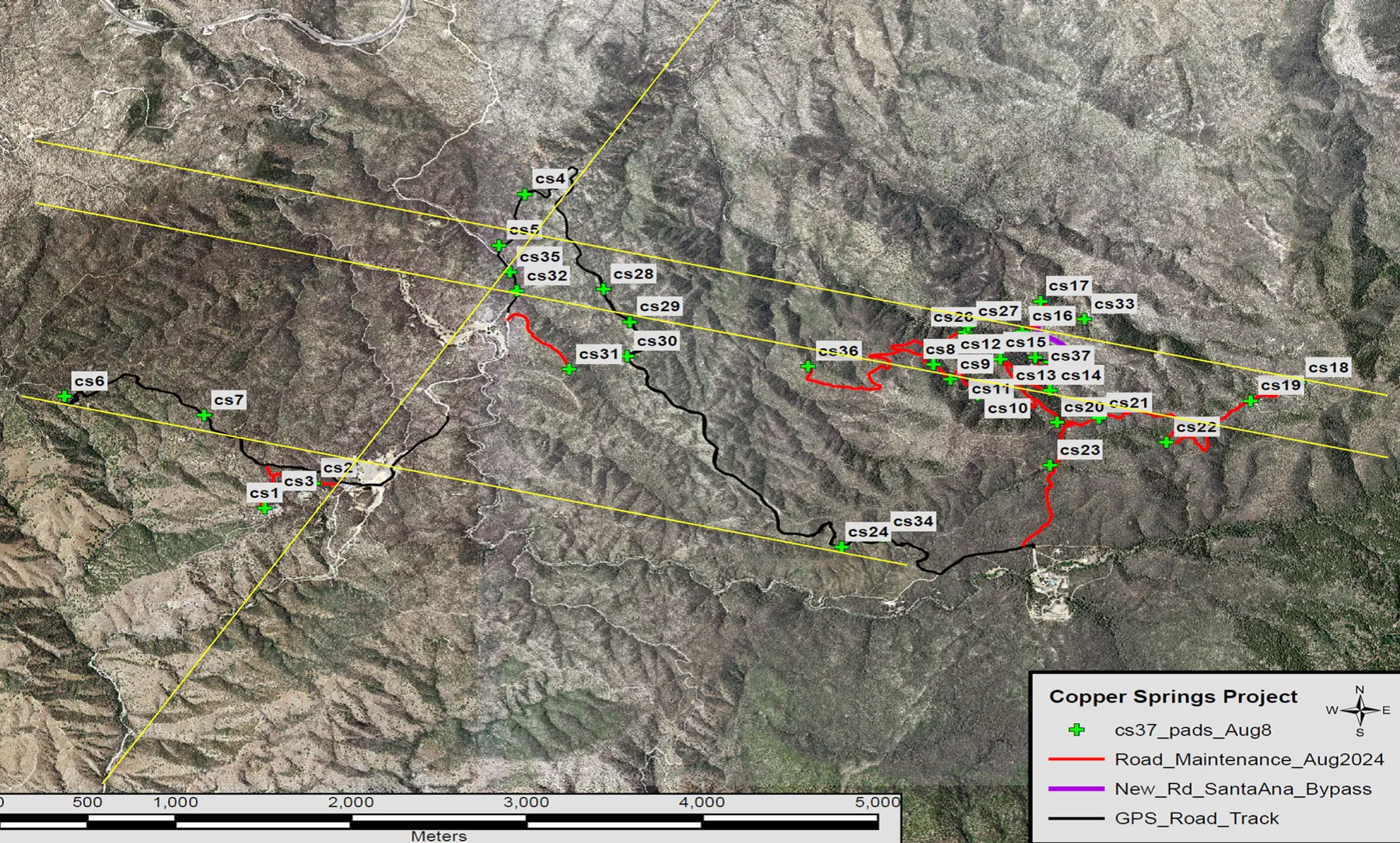
Plan of Operations approved for 37 drill locations, each able to host multiple holes, with three years to complete drilling and reclamation.
3,667 soil samples collected and 2,437 assayed, with a further 1,341 mapped soils awaiting assays. Surface and near-surface sampling has returned copper values up to 1,000 ppm.
635 line-kilometres of drone magnetics over 100 lines, with soils and IP inversions, outline a 6 km wide circular “Donut” chargeability feature at depth.
A 2D IP grid of 15 lines and 48.3 line-kilometres from 1,947 GPS stations. The east side is complete and the west is underway.
The February 2026 survey is complete. Zonge is extending it: as of October 22, 25 stations were delivered and 63 were in processing.
454 rock and 399 channel samples collected, including 396 metres of channel sampling, with 3,614 structural measurements mapped across the project.
Select a figure to view it full size.